Water network analysis on GIS,
in one tool.
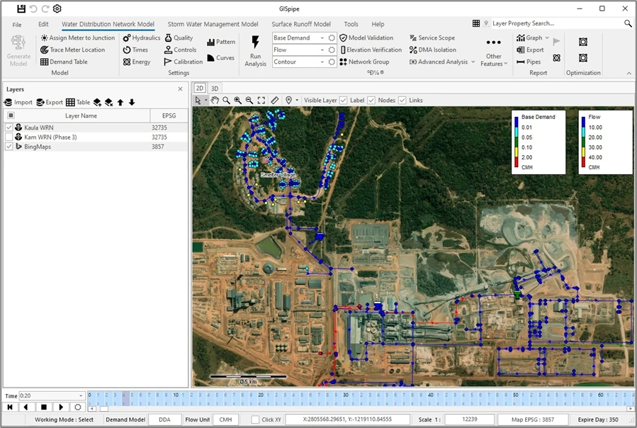
GISpipe brings EPANET water distribution analysis and SWMM storm and sewer analysis together on GIS. Validate and correct facility data, build models and run simulations in one place.
Free license codes are available for universities and research institutes.
Features
From water supply to storm and flood,
everything network analysis needs
Load GIS facility data, fix its errors, build an analysis model and run the simulation.
Validation and correction
Finds connectivity errors in large GIS water facility datasets and corrects them automatically.
Automatic pipe correctionDistribution simulation
Analyzes pressure, flow, demand patterns, pumps and booster stations with the EPANET engine.
EPANETStorm and flood analysis
Combines SWMM with a 2D surface runoff model to analyze sewer networks and flood extent.
SWMM · 2D integrationTurbidity model
Simulates turbidity in the network to support water quality management and flushing plans.
Water qualityWhy GISpipe
From water to sewer, in one program
01
Water and sewer in one
From water distribution analysis (EPANET) to 1D and 2D storm and sewer analysis (SWMM), all in one program.
02
No other software needed
No ArcGIS, no AutoCAD. Install GISpipe and go from model building to 2D and 3D results and reports.
03
Standard engines
Built on the world-standard EPANET 2.2 and SWMM 5.2 engines, so existing model files and results stay compatible.
04
Proven in Korea
Used by local governments and more than 130 engineering firms in Korea.
05
1/20 the cost of comparable software
Every water and sewer feature, with no limit on the number of pipes, at 1/20 the cost of comparable commercial software.
* Based on published one-year, single-user subscription prices for major commercial network modeling software with unlimited pipes, as of October 2026. Prices vary with exchange rates.
Download
Installer and manuals
Download the installer, sample data and user manuals.
Learn
Follow the examples
and get started
Download the installer, sample data and manuals, then learn GISpipe step by step with the tutorials.
Considering GISpipe?
We will send you a quote for licenses and training. Universities and research institutes get free license codes. Send us the form and we will get back to you.